
Thank you for supporting this site ❤️
Make a donation
Make a donation
Belten topographic map
Click on the map to display elevation.
Thank you for supporting this site ❤️
Make a donation
Make a donation
About this map
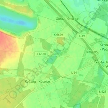
Name: Belten topographic map, elevation, terrain.
Average elevation: 64 m
Minimum elevation: 44 m
Maximum elevation: 91 m
Thank you for supporting this site ❤️
Make a donation
Make a donation
Other topographic maps
Click on a map to view its topography, its elevation and its terrain.
Gahlen
Deutschland > Brandenburg > Oberspreewald-Lausitz > Vetschau/Spreewald
Nach dem Vergleich vom 12. Dezember 1570 erhielt Bastian von Zabeltitz das Dorf Gahlen. Das Erbe Heinrichs wurde von einer Kommission bewertet und zu diesem Wert dem Bastian von Zabeltitz überlassen. Er durfte aber vorher noch seinen Erbanteil in Höhe von 3.000 Talern abziehen. Die Vettern sollten ihre…
Average elevation: 76 m
Raddusch
Deutschland > Brandenburg > Oberspreewald-Lausitz > Vetschau/Spreewald
Average elevation: 53 m