Sant Esteve d'en Bas topographic map
Interactive map
Click on the map to display elevation.
About this map
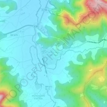
Name: Sant Esteve d'en Bas topographic map, elevation, terrain.
Average elevation: 560 m
Minimum elevation: 465 m
Maximum elevation: 921 m

Click on the map to display elevation.
Name: Sant Esteve d'en Bas topographic map, elevation, terrain.
Average elevation: 560 m
Minimum elevation: 465 m
Maximum elevation: 921 m