
Meckling Township topographic map
Interactive map
Click on the map to display elevation.
About this map
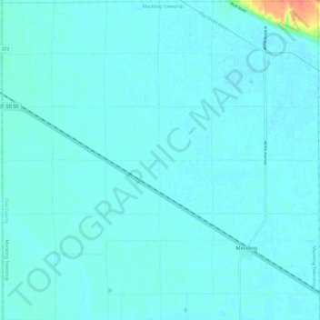
Name: Meckling Township topographic map, elevation, terrain.
Location: Meckling Township, Clay County, South Dakota, United States (42.82265 -97.16077 42.91007 -97.04236)
Average elevation: 354 m
Minimum elevation: 350 m
Maximum elevation: 394 m
Other topographic maps
Click on a map to view its topography, its elevation and its terrain.
Wakonda
United States > South Dakota > Clay County
Wakonda, Star Township, Clay County, South Dakota, United States
Average elevation: 422 m
Vermillion
United States > South Dakota > Clay County
Vermillion, Vermillion Township, Clay County, South Dakota, 57069, United States
Average elevation: 366 m
Vermillion
United States > South Dakota > Clay County > Vermillion
Vermillion, Clay County, South Dakota, 57069, United States
Average elevation: 379 m