
Thank you for supporting this site ❤️
Make a donation
Make a donation
Bat-ongan topographic map
Click on the map to display elevation.
Thank you for supporting this site ❤️
Make a donation
Make a donation
About this map
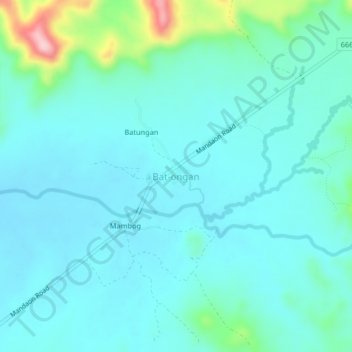
Name: Bat-ongan topographic map, elevation, terrain.
Location: Bat-ongan, Masbate, Bicol Region, Philippines (12.29548 123.34426 12.33548 123.38426)
Average elevation: 76 m
Minimum elevation: 42 m
Maximum elevation: 246 m
Thank you for supporting this site ❤️
Make a donation
Make a donation
Other topographic maps
Click on a map to view its topography, its elevation and its terrain.