
Thank you for supporting this site ❤️
Make a donation
Make a donation
Cospeda topographic map
Click on the map to display elevation.
Thank you for supporting this site ❤️
Make a donation
Make a donation
About this map
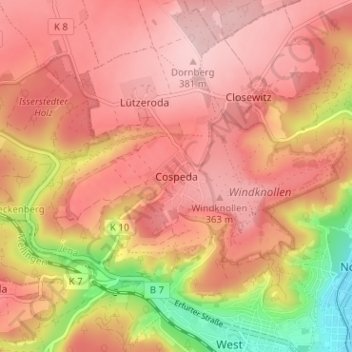
Name: Cospeda topographic map, elevation, terrain.
Location: Cospeda, Jena, Thüringen, 07751, Deutschland (50.93091 11.53962 50.97091 11.57962)
Average elevation: 302 m
Minimum elevation: 144 m
Maximum elevation: 383 m
Thank you for supporting this site ❤️
Make a donation
Make a donation