
Santa Luisa topographic map
Interactive map
Click on the map to display elevation.
About this map
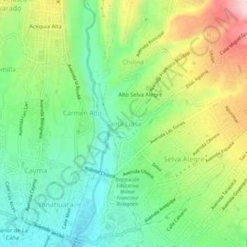
Name: Santa Luisa topographic map, elevation, terrain.
Location: Santa Luisa, Alto Selva Alegre, Arequipa, 04003, Perú (-16.39396 -71.55076 -16.35396 -71.51076)
Average elevation: 2,458 m
Minimum elevation: 2,325 m
Maximum elevation: 2,688 m
Other topographic maps
Click on a map to view its topography, its elevation and its terrain.
Chilina
Perú > Arequipa > Alto Selva Alegre
Chilina, Alto Selva Alegre, Arequipa, 04003, Perú
Average elevation: 2,502 m