
Yosemite topographic map
Interactive map
Click on the map to display elevation.
About this map
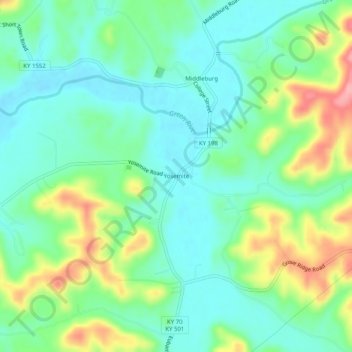
Name: Yosemite topographic map, elevation, terrain.
Location: Yosemite, Casey County, Kentucky, 42541, Estados Unidos (37.32674 -84.84467 37.36674 -84.80467)
Average elevation: 285 m
Minimum elevation: 248 m
Maximum elevation: 367 m