
Hellenthal topographic map
Interactive map
Click on the map to display elevation.
About this map
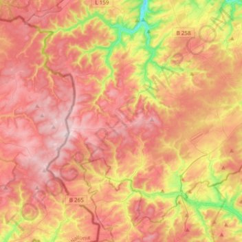
Name: Hellenthal topographic map, elevation, terrain.
Average elevation: 567 m
Minimum elevation: 378 m
Maximum elevation: 697 m
Other topographic maps
Click on a map to view its topography, its elevation and its terrain.
Hoven
Germany > North Rhine-Westphalia > Kreis Euskirchen > Zülpich
Hoven, Zülpich, Kreis Euskirchen, North Rhine-Westphalia, 53909, Germany
Average elevation: 171 m
Weilerswist
Germany > North Rhine-Westphalia > Kreis Euskirchen > Weilerswist
Weilerswist, Kreis Euskirchen, North Rhine-Westphalia, 53919, Germany
Average elevation: 129 m