
Machaguay topographic map
Interactive map
Click on the map to display elevation.
About this map
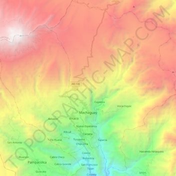
Name: Machaguay topographic map, elevation, terrain.
Location: Machaguay, Provincia de Castilla, Arequipa, Perú (-15.73240 -72.55762 -15.50539 -72.38531)
Average elevation: 4,072 m
Minimum elevation: 1,853 m
Maximum elevation: 6,292 m