
Thank you for supporting this site ❤️
Make a donation
Make a donation
Karawanella topographic map
Click on the map to display elevation.
Thank you for supporting this site ❤️
Make a donation
Make a donation
About this map
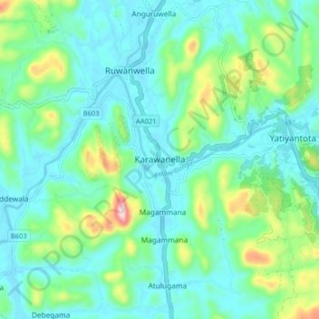
Name: Karawanella topographic map, elevation, terrain.
Location: Karawanella, Kegalle District, Sabaragamuwa Province, Sri Lanka (6.98357 80.22138 7.06357 80.30138)
Average elevation: 96 m
Minimum elevation: 14 m
Maximum elevation: 386 m
Thank you for supporting this site ❤️
Make a donation
Make a donation
Other topographic maps
Click on a map to view its topography, its elevation and its terrain.