
山ノ内町 topographic map
Interactive map
Click on the map to display elevation.
About this map
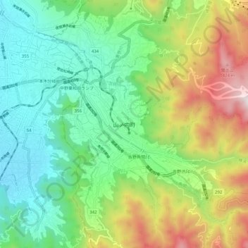
Name: 山ノ内町 topographic map, elevation, terrain.
Location: 山ノ内町, 下高井郡, Präfektur Nagano, Chūbu, 3810401, Japan (36.70466 138.37267 36.78466 138.45267)
Average elevation: 726 m
Minimum elevation: 333 m
Maximum elevation: 1,519 m