
Thank you for supporting this site ❤️
Make a donation
Make a donation
Blandford Forum topographic map
Click on the map to display elevation.
Thank you for supporting this site ❤️
Make a donation
Make a donation
About this map
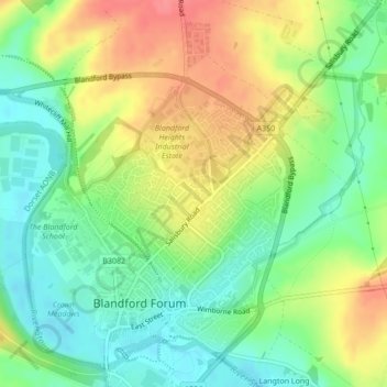
Name: Blandford Forum topographic map, elevation, terrain.
Location: Blandford Forum, Dorset, England, United Kingdom (50.85322 -2.17576 50.87725 -2.13991)
Average elevation: 60 m
Minimum elevation: 29 m
Maximum elevation: 101 m
Thank you for supporting this site ❤️
Make a donation
Make a donation