
Mattighofen topographic map
Interactive map
Click on the map to display elevation.
Mattighofen
Mattighofen liegt auf 454 m Höhe im Innviertel. Die Ausdehnung beträgt von Nord nach Süd 3 km, von West nach Ost 3,3 km. Die Gesamtfläche beträgt 5,2 km². 13,5 % der Fläche sind bewaldet, 50,0 % der Fläche sind landwirtschaftlich genutzt.
About this map
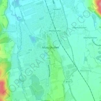
Name: Mattighofen topographic map, elevation, terrain.
Average elevation: 451 m
Minimum elevation: 430 m
Maximum elevation: 533 m