
Exeter topographic map
Interactive map
Click on the map to display elevation.
About this map
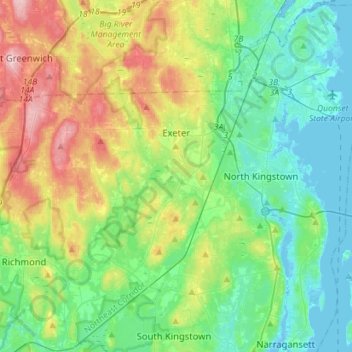
Name: Exeter topographic map, elevation, terrain.
Location: Exeter, South County, Rhode Island, 02822, United States (41.50006 -71.79142 41.60252 -71.50789)
Average elevation: 56 m
Minimum elevation: -6 m
Maximum elevation: 186 m