
Hooglede topographic map
Interactive map
Click on the map to display elevation.
About this map
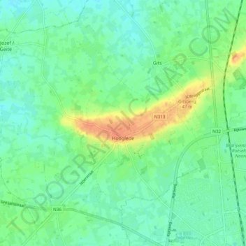
Name: Hooglede topographic map, elevation, terrain.
Location: Hooglede, Roeselare, Westflandern, Flandern, 8830, Belgien (50.95726 3.01844 51.00707 3.11338)
Average elevation: 26 m
Minimum elevation: 13 m
Maximum elevation: 52 m