
Mudumalai National Park/Tiger Reserve topographic map
Interactive map
Click on the map to display elevation.
About this map
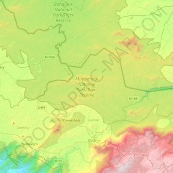
Name: Mudumalai National Park/Tiger Reserve topographic map, elevation, terrain.
Average elevation: 1,011 m
Minimum elevation: 68 m
Maximum elevation: 2,494 m
Other topographic maps
Click on a map to view its topography, its elevation and its terrain.
Devala
India > Tamil Nadu > Gudalur
Devala, Gudalur, Nilgiris District, Tamil Nadu, 643241, India
Average elevation: 913 m