
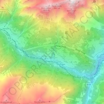
Gemeinde Strengen topographic map
Interactive map
Click on the map to display elevation.
About this map
Name: Gemeinde Strengen topographic map, elevation, terrain.
Location: Gemeinde Strengen, Bezirk Landeck, Tirol, 6571, Österreich (47.09922 10.41945 47.16727 10.49313)
Average elevation: 1,682 m
Minimum elevation: 855 m
Maximum elevation: 2,948 m