
Saleli topographic map
Click on the map to display elevation.
About this map
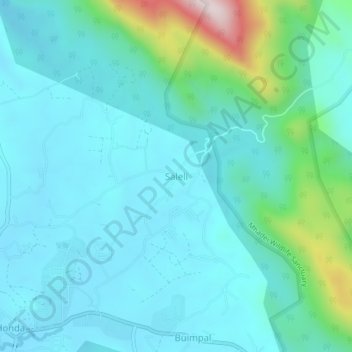
Name: Saleli topographic map, elevation, terrain.
Location: Saleli, Satari, North Goa, Goa, India (15.54035 74.05819 15.58035 74.09819)
Average elevation: 135 m
Minimum elevation: 40 m
Maximum elevation: 601 m
Other topographic maps
Click on a map to view its topography, its elevation and its terrain.