
Addanki topographic map
Interactive map
Click on the map to display elevation.
About this map
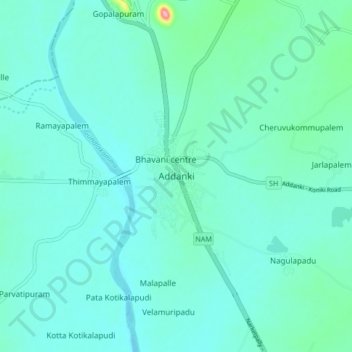
Name: Addanki topographic map, elevation, terrain.
Location: Addanki, Prakasam, Andhra Pradesh, India (15.77103 79.93379 15.85103 80.01379)
Average elevation: 38 m
Minimum elevation: 20 m
Maximum elevation: 153 m
Addanki located at 15°49′00″N 79°59′00″E / 15.8167°N 79.9833°E / 15.8167; 79.9833. It has an average elevation of 24 meters (82 ft). It is located between Guntur (70 km) and Ongole (36 km) and Chialakaluripet (44 km) and Narasaraopet (50 km).