
Thank you for supporting this site ❤️
Make a donation
Make a donation
Iron Ridge topographic map
Click on the map to display elevation.
Thank you for supporting this site ❤️
Make a donation
Make a donation
About this map
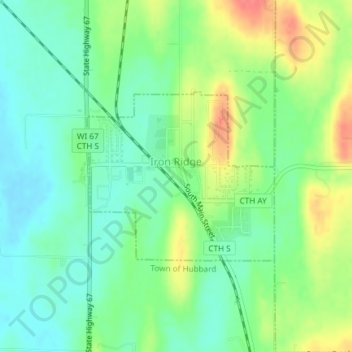
Name: Iron Ridge topographic map, elevation, terrain.
Location: Iron Ridge, Dodge County, Wisconsin, United States (43.39209 -88.54200 43.40503 -88.52215)
Average elevation: 286 m
Minimum elevation: 262 m
Maximum elevation: 327 m
Thank you for supporting this site ❤️
Make a donation
Make a donation
Other topographic maps
Click on a map to view its topography, its elevation and its terrain.