
Jagdschloss Letzlingen topographic map
Interactive map
Click on the map to display elevation.
About this map
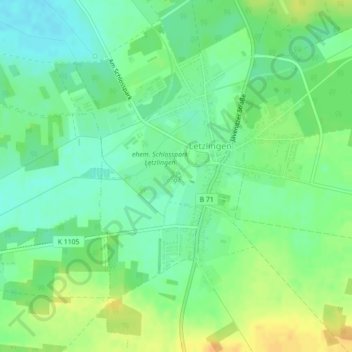
Name: Jagdschloss Letzlingen topographic map, elevation, terrain.
Average elevation: 75 m
Minimum elevation: 62 m
Maximum elevation: 92 m
Other topographic maps
Click on a map to view its topography, its elevation and its terrain.
Dannefeld
Deutschland > Sachsen-Anhalt > Gardelegen > Dannefeld
Dannefeld, Gardelegen, Altmarkkreis Salzwedel, Sachsen-Anhalt, Deutschland
Average elevation: 60 m