
Gyeyang-gu topographic map
Interactive map
Click on the map to display elevation.
About this map
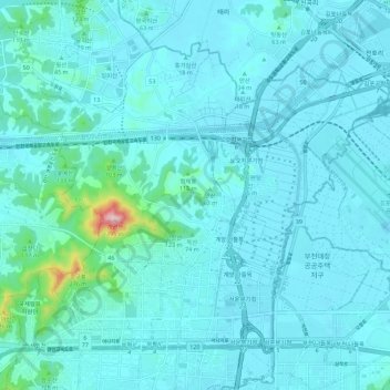
Name: Gyeyang-gu topographic map, elevation, terrain.
Location: Gyeyang-gu, Incheon, South Korea (37.52358 126.68105 37.59367 126.79363)
Average elevation: 34 m
Minimum elevation: -9 m
Maximum elevation: 378 m
Other topographic maps
Click on a map to view its topography, its elevation and its terrain.
Songdo-dong
South Korea > Incheon > Yeonsu-gu
Songdo-dong, Yeonsu-gu, Incheon, South Korea
Average elevation: 7 m
Sinpo-dong
South Korea > Incheon > Jung-gu
Sinpo-dong, Jung-gu, Incheon, South Korea
Average elevation: 14 m
Gyesan-dong
South Korea > Incheon > Gyeyang-gu > Gyesan-dong
Gyesan-dong, Gyeyang-gu, Incheon, South Korea
Average elevation: 66 m
Wondang-dong
South Korea > Incheon > Seo-gu > Wondang-dong
Wondang-dong, Seo-gu, Incheon, 22625, South Korea
Average elevation: 41 m
Ongnyeon-dong
South Korea > Incheon > Ongnyeon-dong
Ongnyeon-dong, Yeonsu-gu, Incheon, South Korea
Average elevation: 27 m