
Thank you for supporting this site ❤️
Make a donation
Make a donation
Kokatahi River topographic map
Click on the map to display elevation.
Thank you for supporting this site ❤️
Make a donation
Make a donation
About this map
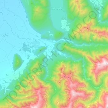
Name: Kokatahi River topographic map, elevation, terrain.
Location: Kokatahi River, Westland District, West Coast, New Zealand (-42.99114 171.01874 -42.82109 171.23648)
Average elevation: 516 m
Minimum elevation: 16 m
Maximum elevation: 1,858 m
Thank you for supporting this site ❤️
Make a donation
Make a donation