
Pauni Taluka topographic map
Interactive map
Click on the map to display elevation.
About this map
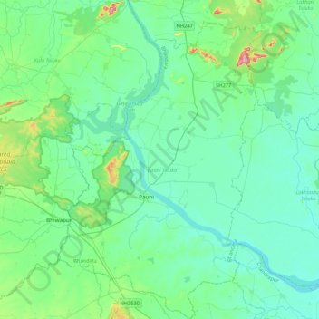
Name: Pauni Taluka topographic map, elevation, terrain.
Location: Pauni Taluka, Bhandara District, Maharashtra, India (20.64149 79.51801 21.01061 79.79018)
Average elevation: 249 m
Minimum elevation: 213 m
Maximum elevation: 449 m
Other topographic maps
Click on a map to view its topography, its elevation and its terrain.
Shivnala (Gondi)
India > Maharashtra > Pauni Taluka
Shivnala (Gondi), Pauni Taluka, Bhandara, Maharashtra, India
Average elevation: 242 m