
Thank you for supporting this site ❤️
Make a donation
Make a donation
Jowar topographic map
Click on the map to display elevation.
Thank you for supporting this site ❤️
Make a donation
Make a donation
About this map
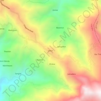
Name: Jowar topographic map, elevation, terrain.
Location: Jowar, Shangla, Khyber Pakhtunkhwa, Pakistan (34.59290 72.65516 34.63290 72.69516)
Average elevation: 1,537 m
Minimum elevation: 973 m
Maximum elevation: 2,160 m
Thank you for supporting this site ❤️
Make a donation
Make a donation