
La Bagne topographic map
Interactive map
Click on the map to display elevation.
About this map
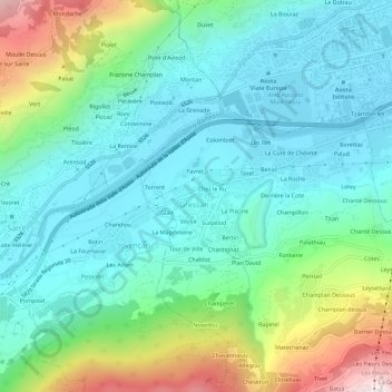
Name: La Bagne topographic map, elevation, terrain.
Location: La Bagne, Gressan, Vallée d'Aoste, 11100, Italie (45.70002 7.26542 45.74002 7.30542)
Average elevation: 795 m
Minimum elevation: 564 m
Maximum elevation: 1,476 m