
Thank you for supporting this site ❤️
Make a donation
Make a donation
Qongkol topographic map
Click on the map to display elevation.
Thank you for supporting this site ❤️
Make a donation
Make a donation
About this map
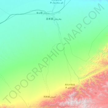
Name: Qongkol topographic map, elevation, terrain.
Location: Qongkol, Qarqan County, Bayingolin, Xinjiang, China (37.37940 84.18577 38.14472 85.65141)
Average elevation: 2,061 m
Minimum elevation: 1,151 m
Maximum elevation: 6,186 m
Thank you for supporting this site ❤️
Make a donation
Make a donation
Other topographic maps
Click on a map to view its topography, its elevation and its terrain.