Hausen/Rhön topographic map
Interactive map
Click on the map to display elevation.
About this map
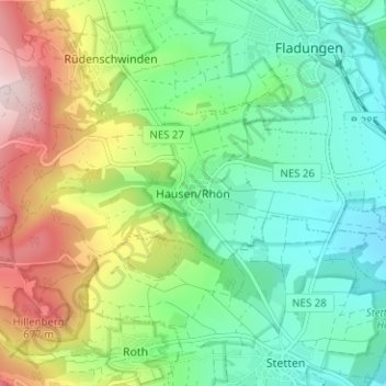
Name: Hausen/Rhön topographic map, elevation, terrain.
Average elevation: 494 m
Minimum elevation: 372 m
Maximum elevation: 736 m

Click on the map to display elevation.
Name: Hausen/Rhön topographic map, elevation, terrain.
Average elevation: 494 m
Minimum elevation: 372 m
Maximum elevation: 736 m