
ჩვიბიანი topographic map
Interactive map
Click on the map to display elevation.
About this map
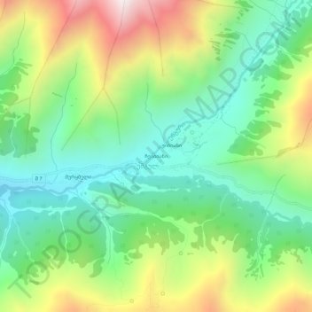
Name: ჩვიბიანი topographic map, elevation, terrain.
Average elevation: 2,413 m
Minimum elevation: 2,000 m
Maximum elevation: 3,158 m
Other topographic maps
Click on a map to view its topography, its elevation and its terrain.
Ouchgouli
Géorgie > Mingrélie-et-Haute-Svanétie > მესტიის რაიონი > Ouchgouli
Ouchgouli, მესტიის რაიონი, Mingrélie-et-Haute-Svanétie, Géorgie
Average elevation: 2,409 m