
Thank you for supporting this site ❤️
Make a donation
Make a donation
Sawangi topographic map
Click on the map to display elevation.
Thank you for supporting this site ❤️
Make a donation
Make a donation
About this map
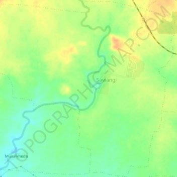
Name: Sawangi topographic map, elevation, terrain.
Location: Sawangi, Warud, Amravati, Maharashtra, India (21.44510 78.34672 21.48047 78.38489)
Average elevation: 396 m
Minimum elevation: 379 m
Maximum elevation: 412 m
Thank you for supporting this site ❤️
Make a donation
Make a donation