
Oberes Schloss topographic map
Interactive map
Click on the map to display elevation.
About this map
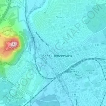
Name: Oberes Schloss topographic map, elevation, terrain.
Average elevation: 449 m
Minimum elevation: 420 m
Maximum elevation: 682 m
Other topographic maps
Click on a map to view its topography, its elevation and its terrain.
Bohlingen
Deutschland > Baden-Württemberg > Landkreis Konstanz > Singen (Hohentwiel)
Bohlingen, Singen (Hohentwiel), Verwaltungsgemeinschaft Singen (Hohentwiel), Landkreis Konstanz, Baden-Württemberg, 78224, Deutschland
Average elevation: 459 m
Beuren an der Aach
Deutschland > Baden-Württemberg > Landkreis Konstanz > Singen (Hohentwiel)
Beuren an der Aach, Singen (Hohentwiel), Verwaltungsgemeinschaft Singen (Hohentwiel), Landkreis Konstanz, Baden-Württemberg, 78224, Deutschland
Average elevation: 453 m