
Borjana topographic map
Interactive map
Click on the map to display elevation.
About this map
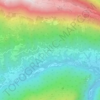
Name: Borjana topographic map, elevation, terrain.
Location: Borjana, Kobarid, Slovenië (46.23572 13.45785 46.27572 13.49785)
Average elevation: 672 m
Minimum elevation: 234 m
Maximum elevation: 1,529 m