
Zeilberg topographic map
Interactive map
Click on the map to display elevation.
About this map
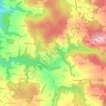
Name: Zeilberg topographic map, elevation, terrain.
Location: Zeilberg, Schärding, Opper-Oostenrijk, 4092, Oostenrijk (48.49056 13.55669 48.53056 13.59669)
Average elevation: 494 m
Minimum elevation: 364 m
Maximum elevation: 597 m