
Thank you for supporting this site ❤️
Make a donation
Make a donation
Maassluis topographic map
Click on the map to display elevation.
Thank you for supporting this site ❤️
Make a donation
Make a donation
About this map
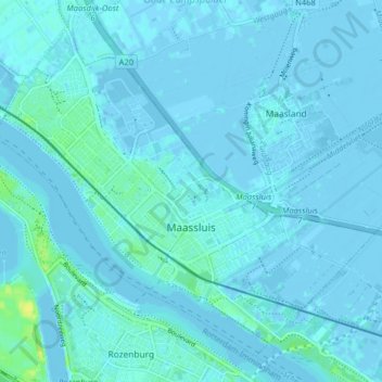
Name: Maassluis topographic map, elevation, terrain.
Location: Maassluis, South Holland, Netherlands (51.90534 4.21272 51.94799 4.29261)
Average elevation: 2 m
Minimum elevation: -5 m
Maximum elevation: 19 m
Thank you for supporting this site ❤️
Make a donation
Make a donation
Other topographic maps
Click on a map to view its topography, its elevation and its terrain.
Capelle aan den IJssel
Netherlands > South Holland > Capelle aan den IJssel
Dutch Topographic map of the municipality of Capelle aan den IJssel, June 2015.
Average elevation: -1 m