
Halbe topographic map
Interactive map
Click on the map to display elevation.
About this map
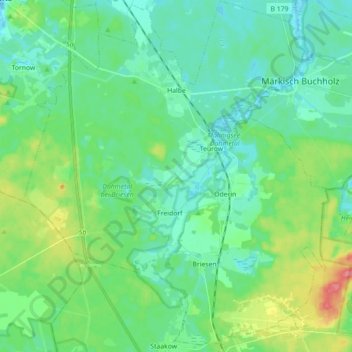
Name: Halbe topographic map, elevation, terrain.
Average elevation: 54 m
Minimum elevation: 36 m
Maximum elevation: 108 m
Other topographic maps
Click on a map to view its topography, its elevation and its terrain.
Bestensee
Deutschland > Brandenburg > Dahme-Spreewald
Bestensee, Dahme-Spreewald, Brandenburg, 15741, Deutschland
Average elevation: 44 m
Schlabendorf
Deutschland > Brandenburg > Dahme-Spreewald > Luckau
Schlabendorf, Luckau, Dahme-Spreewald, Brandenburg, Deutschland
Average elevation: 62 m
Lübben (Spreewald)
Deutschland > Brandenburg > Dahme-Spreewald
Lübben (Spreewald), Dahme-Spreewald, Brandenburg, 15907, Deutschland
Average elevation: 53 m