
Thank you for supporting this site ❤️
Make a donation
Make a donation
Traverse County topographic map
Click on the map to display elevation.
Thank you for supporting this site ❤️
Make a donation
Make a donation
About this map
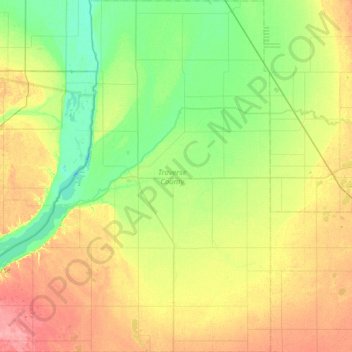
Name: Traverse County topographic map, elevation, terrain.
Location: Traverse County, Minnesota, United States (45.58604 -96.85761 46.02282 -96.25355)
Average elevation: 319 m
Minimum elevation: 293 m
Maximum elevation: 363 m
Thank you for supporting this site ❤️
Make a donation
Make a donation
Other topographic maps
Click on a map to view its topography, its elevation and its terrain.
Thank you for supporting this site ❤️
Make a donation
Make a donation
New Germany
United States > Minnesota > Carver County > New Germany > New Germany
Average elevation: 298 m