
Osnabrück topographic map
Interactive map
Click on the map to display elevation.
About this map
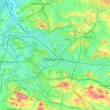
Name: Osnabrück topographic map, elevation, terrain.
Location: Osnabrück, Nedersaksen, Duitsland (52.21755 7.92971 52.33743 8.18066)
Average elevation: 93 m
Minimum elevation: 50 m
Maximum elevation: 229 m