
Trenton topographic map
Interactive map
Click on the map to display elevation.
About this map
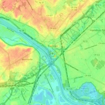
Name: Trenton topographic map, elevation, terrain.
Location: Trenton, Mercer County, New Jersey, États-Unis d'Amérique (40.18383 -74.81958 40.24830 -74.72890)
Average elevation: 19 m
Minimum elevation: -1 m
Maximum elevation: 44 m
Other topographic maps
Click on a map to view its topography, its elevation and its terrain.
Edgewood Avenue Park
États-Unis d'Amérique > New Jersey > Trenton
Edgewood Avenue Park, Perdicaris Place, Trenton, Mercer County, New Jersey, États-Unis d'Amérique
Average elevation: 24 m