
Thank you for supporting this site ❤️
Make a donation
Make a donation
Al Ashkhirah topographic map
Click on the map to display elevation.
Thank you for supporting this site ❤️
Make a donation
Make a donation
About this map
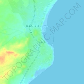
Name: Al Ashkhirah topographic map, elevation, terrain.
Location: Al Ashkhirah, Ash Sharqiyah South, Oman (21.83000 59.55000 21.87000 59.59000)
Average elevation: 8 m
Minimum elevation: -12 m
Maximum elevation: 43 m
Thank you for supporting this site ❤️
Make a donation
Make a donation