
Manus topographic map
Interactive map
Click on the map to display elevation.
About this map
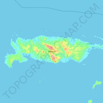
Name: Manus topographic map, elevation, terrain.
Location: Manus, Islands Region, Papua New Guinea (-2.25516 146.50535 -1.95153 147.43888)
Average elevation: 18 m
Minimum elevation: -1 m
Maximum elevation: 676 m
Other topographic maps
Click on a map to view its topography, its elevation and its terrain.