
Thank you for supporting this site ❤️
Make a donation
Make a donation
Darnah topographic map
Click on the map to display elevation.
Thank you for supporting this site ❤️
Make a donation
Make a donation
About this map
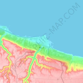
Name: Darnah topographic map, elevation, terrain.
Location: Darnah, Derna, Libya (32.74049 22.55846 32.79231 22.68537)
Average elevation: 85 m
Minimum elevation: -1 m
Maximum elevation: 279 m
Thank you for supporting this site ❤️
Make a donation
Make a donation
Other topographic maps
Click on a map to view its topography, its elevation and its terrain.