
Thank you for supporting this site ❤️
Make a donation
Make a donation
Langeneichstädt topographic map
Click on the map to display elevation.
Thank you for supporting this site ❤️
Make a donation
Make a donation
About this map
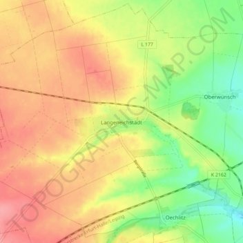
Name: Langeneichstädt topographic map, elevation, terrain.
Average elevation: 176 m
Minimum elevation: 132 m
Maximum elevation: 212 m
Thank you for supporting this site ❤️
Make a donation
Make a donation
Other topographic maps
Click on a map to view its topography, its elevation and its terrain.
Niederwünsch
Deutschland > Sachsen-Anhalt > Saalekreis > Mücheln (Geiseltal) > Niederwünsch
Average elevation: 140 m
St. Ulrich
Deutschland > Sachsen-Anhalt > Saalekreis > Mücheln (Geiseltal) > St. Micheln
Average elevation: 157 m