
Kumhari topographic map
Interactive map
Click on the map to display elevation.
About this map
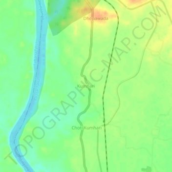
Name: Kumhari topographic map, elevation, terrain.
Location: Kumhari, Balagat Tahsil, Balaghat, Madhya Pradesh, India (21.86065 80.16675 21.90065 80.20675)
Average elevation: 307 m
Minimum elevation: 290 m
Maximum elevation: 326 m