
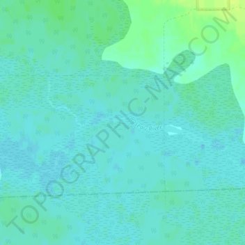
Roseau River topographic map
Interactive map
Click on the map to display elevation.
About this map
Name: Roseau River topographic map, elevation, terrain.
Average elevation: 375 m
Minimum elevation: 371 m
Maximum elevation: 386 m
Other topographic maps
Click on a map to view its topography, its elevation and its terrain.
Red River
United States of America > Minnesota
Red River, Grand Forks County, Minnesota, 58001, United States of America
Average elevation: 380 m
Maplewood
United States of America > Minnesota > Maplewood
Maplewood, Ramsey County, Minnesota, 55109, United States of America
Average elevation: 284 m
Rainy River
United States of America > Minnesota
Rainy River, Saint Louis County, Minnesota, United States of America
Average elevation: 344 m
Basswood Lake
United States of America > Minnesota
Basswood Lake, Lake County, Minnesota, United States of America
Average elevation: 427 m
Darfur
United States of America > Minnesota > Darfur
Darfur, Watonwan County, Minnesota, 56022, United States of America
Average elevation: 349 m
Sturgeon Lake
United States of America > Minnesota > Sturgeon Lake > Sturgeon Lake
Sturgeon Lake, Pine County, Minnesota, 55783, United States of America
Average elevation: 330 m
Crosslake
United States of America > Minnesota > Crosslake
Crosslake, Crow Wing, Minnesota, 56442, United States of America
Average elevation: 378 m
Lake One
United States of America > Minnesota
Lake One, Lake County, Minnesota, United States of America
Average elevation: 457 m
Carlos
United States of America > Minnesota > Carlos
Carlos, Douglas County, Minnesota, United States of America
Average elevation: 418 m
Diamond Lake
United States of America > Minnesota > Minneapolis
Diamond Lake, Minneapolis, Hennepin County, Minnesota, United States of America
Average elevation: 258 m
Brownton
United States of America > Minnesota > Brownton
Brownton, McLeod County, Minnesota, United States of America
Average elevation: 314 m
Climax
United States of America > Minnesota > Climax
Climax, Polk County, Minnesota, 56523, United States of America
Average elevation: 263 m
Ivanhoe
United States of America > Minnesota > Ivanhoe
Ivanhoe, Lincoln County, Minnesota, 56142, United States of America
Average elevation: 509 m
Trimble Park
United States of America > Minnesota > Milaca
Trimble Park, Milaca, Mille Lacs County, Minnesota, United States of America
Average elevation: 327 m
Clearwater River
United States of America > Minnesota > Clearwater
Clearwater River, Clearwater, Wright County, Minnesota, 55320, United States of America
Average elevation: 302 m
Chester
United States of America > Minnesota > Chester
Chester, Olmsted County, Minnesota, United States of America
Average elevation: 360 m
Bailey
United States of America > Minnesota > Bailey
Bailey, Sherburne County, Minnesota, United States of America
Average elevation: 280 m
Wolverton
United States of America > Minnesota > Wolverton
Wolverton, Wilkin County, Minnesota, 56594, United States of America
Average elevation: 284 m
Elbow Lake
United States of America > Minnesota > Elbow Lake
Elbow Lake, Grant County, Minnesota, 56531, United States of America
Average elevation: 368 m
Gem Lake
United States of America > Minnesota > Gem Lake
Gem Lake, Ramsey County, Minnesota, United States of America
Average elevation: 289 m
Helena Lake
United States of America > Minnesota
Helena Lake, 390th Avenue, Waseca County, Minnesota, 56048, United States of America
Average elevation: 337 m
Myrtle
United States of America > Minnesota > Myrtle
Myrtle, Freeborn County, Minnesota, United States of America
Average elevation: 383 m
Skeleton Lake
United States of America > Minnesota > Eagles Nest
Skeleton Lake, Migisi Road, Eagles Nest, Saint Louis County, Minnesota, United States of America
Average elevation: 463 m
Octopus Lake
United States of America > Minnesota
Octopus Lake, Cook County, Minnesota, United States of America
Average elevation: 553 m