
Ely topographic map
Interactive map
Click on the map to display elevation.
About this map
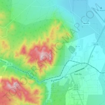
Name: Ely topographic map, elevation, terrain.
Average elevation: 2,045 m
Minimum elevation: 1,896 m
Maximum elevation: 2,432 m
Ely liegt bei 39° 15′ N, 114° 53′ W39.253333333333-114.877222222221962 in einer Höhe von 1962 m über dem Meeresspiegel am U.S. Highway 50, dessen Teilstück zwischen Ely und Fallon the loneliest road in America genannt wird. In der Nähe Elys liegt der Great-Basin-Nationalpark.