
Thank you for supporting this site ❤️
Make a donation
Make a donation
Carytown topographic map
Click on the map to display elevation.
Thank you for supporting this site ❤️
Make a donation
Make a donation
About this map
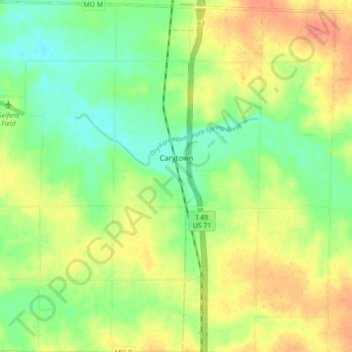
Name: Carytown topographic map, elevation, terrain.
Location: Carytown, Jasper County, Missouri, United States (37.22740 -94.36388 37.29742 -94.30372)
Average elevation: 294 m
Minimum elevation: 273 m
Maximum elevation: 316 m
Thank you for supporting this site ❤️
Make a donation
Make a donation
Other topographic maps
Click on a map to view its topography, its elevation and its terrain.