
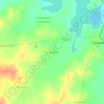
Kodagihalli topographic map
Interactive map
Click on the map to display elevation.
About this map
Name: Kodagihalli topographic map, elevation, terrain.
Average elevation: 805 m
Minimum elevation: 782 m
Maximum elevation: 834 m
Other topographic maps
Click on a map to view its topography, its elevation and its terrain.
Sampige Road
India > Karnataka > Turuvekere taluk > Mastigondanahalli
Sampige Road, Mastigondanahalli, Turuvekere taluk, Tumkur district, Karnataka, India
Average elevation: 817 m