
Thank you for supporting this site ❤️
Make a donation
Make a donation
Kentucky Island topographic map
Click on the map to display elevation.
Thank you for supporting this site ❤️
Make a donation
Make a donation
About this map
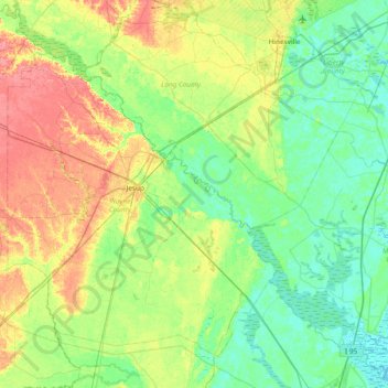
Name: Kentucky Island topographic map, elevation, terrain.
Location: Kentucky Island, Wayne County, Georgia, United States (31.27549 -82.09067 31.91549 -81.45067)
Average elevation: 19 m
Minimum elevation: -2 m
Maximum elevation: 60 m
Thank you for supporting this site ❤️
Make a donation
Make a donation
Other topographic maps
Click on a map to view its topography, its elevation and its terrain.