
果园乡 topographic map
Interactive map
Click on the map to display elevation.
About this map
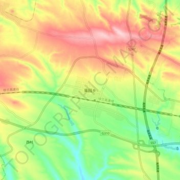
Name: 果园乡 topographic map, elevation, terrain.
Location: 果园乡, 渑池县, 三门峡市, Henan, China (34.65088 111.72574 34.73088 111.80574)
Average elevation: 562 m
Minimum elevation: 459 m
Maximum elevation: 671 m