
Mercer County topographic map
Interactive map
Click on the map to display elevation.
About this map
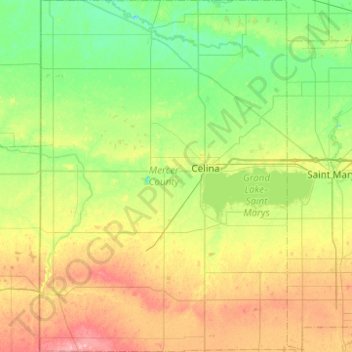
Name: Mercer County topographic map, elevation, terrain.
Location: Mercer County, Ohio, VS (40.35194 -84.80424 40.72815 -84.43420)
Average elevation: 271 m
Minimum elevation: 236 m
Maximum elevation: 336 m
Other topographic maps
Click on a map to view its topography, its elevation and its terrain.
Cuyahoga Valley National Park
Cuyahoga Valley National Park, Boston, Boston Township, Summit County, Ohio, VS
Average elevation: 308 m